| Weather Data | |||
|---|---|---|---|
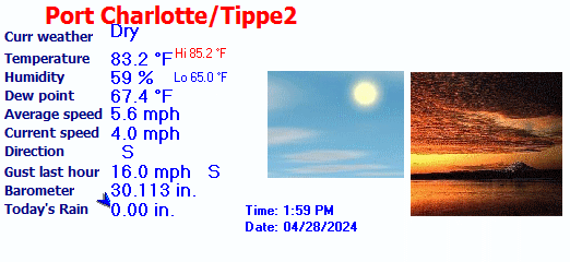
| LAST READING AT TIME: 1:26 PM DATE: June 14 2024, time of next update: 1:27 pm | |||
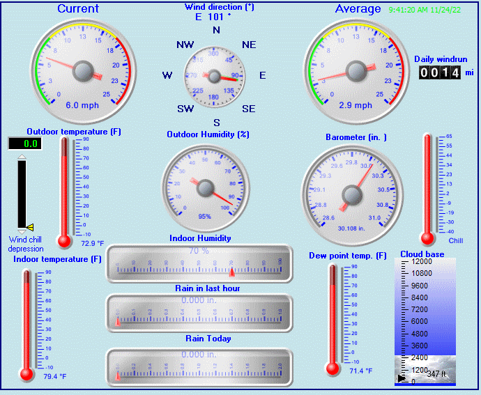
| Current Weather | Dry | Current Temperature | 87.2°F (30.7°C) (Heat Index 105.0°F ), Apparent temp 94.6°F |
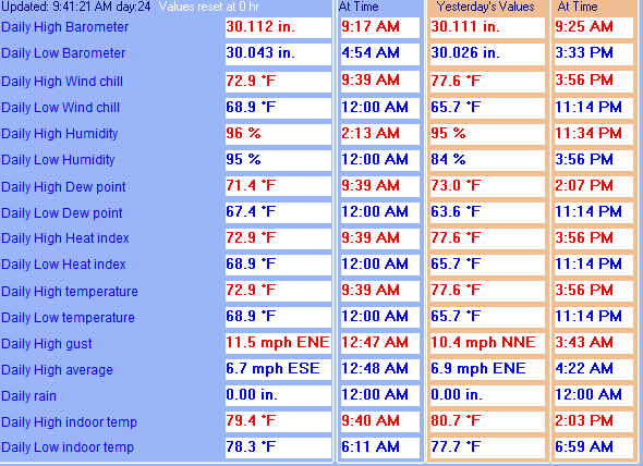
| Maximum Temperature (since midnight) | 89.7°F at: 12:00 PM | Minimum Temperature (since midnight) | 74.4°F at: 5:19 AM |
| Average windspeed (ten minute) | 4.4 mph | Wind Direction (ten minute) | W (268°) |
| Heat Index | 105.0°F | Maximum Gust (last hour) | 13.0 mph at: 1:06 PM |
| Maximum Gust (since midnight) | 13.0 mph at: 1:06 PM | Maximum 1 minute average (since midnight) | 8.9 mph at: 1:07 PM |
| Rainfall (last hour) | 0.00 in. (0.0 mm) | Rainfall (since midnight) | 41.92 in. (1064.8 mm) at 5:46 AM |
| Rainfall This month | 222.60 in. (5654.0 mm) | Rainfall To date this year | 234.90 in. (5966.5 mm) |
| Maximum rain per minute (last hour) | 0.00 in/min | Maximum rain per hour (last 6 hours) | 0.00 in/hour |
| Yesterdays rainfall | 64.86 in | DewPoint | 81.0°F (Wet Bulb :82.7°F ) |
| Humidity | 82 %, Humidex 114.1°F | Barometer corrected to msl | 29.911 in. (1012.9 hPa) |
| Pressure change | +0.01 in. (last hour) | Trend (last hour) | STEADY |
| Pressure change (last 12 hours) | +0.03 in | Pressure change (last 6 hours) | +0.01 in |

Use the RELOAD facility on your browser to retrieve the latest data.


